Seabed Mapping for Great Sea Interconnector Set to Begin Next Week
ADMIE Prepares for Seabed Survey to Finalize Route for the Interconnector Project
ADMIE (Greek Independent Power Transmission Operator), as the project implementer, is expected to give the green light next week for the start of seabed mapping surveys, aiming to select the best route for the Crete-Cyprus Interconnector.
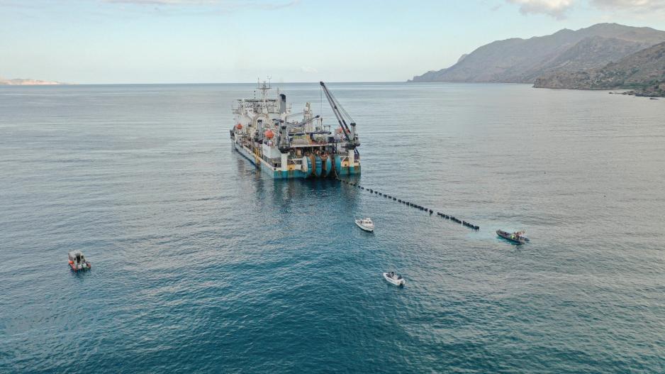
According to Brief, a specialized research vessel is expected to investigate and map the precise path for the cable, which will stretch from Vasilikos to Crete and from there to the Peloponnese and mainland Greece, near Piraeus.
These research operations are anticipated to enhance data collected since 2016, when the first seabed mapping between Greece and Cyprus was conducted for the route of the Euroasia Interconnector, now known as the Great Sea Interconnector.
The vessel will conduct detailed mapping, even in challenging areas, such as the zone south of Vasilikos and within a distance of 20 to 40 kilometers from the coast, where significant depth variations are recorded. The goal is to identify the point where the cable will pass through the "Cypriot Arc."
The vessel’s survey to determine the route of the Interconnector is expected to be completed in approximately one month.
Simultaneously, the necessary environmental impact study and detailed technical study are progressing, with a focus on cable sections passing through very deep waters, some exceeding 2,000 meters in certain areas. These studies will also determine the cable-laying techniques.
It’s worth recalling that in 2017, when the "Odin Finder" vessel carried out seabed mapping, Turkey attempted to create faits accomplis within the Greek NAVTEX authority region and the Greek continental shelf.
The vessel was working on behalf of the Greece-Cyprus-Israel consortium for the cable-laying project under the Euroasia Interconnector plan.
Turkey issued another NAVTEX (the third in a row), announcing research by an Italian-flagged vessel in areas overlapping with the Greek and Cypriot continental shelves, specifically between Crete and Karpathos, outside Crete's territorial waters.
With this NAVTEX issuance, Turkey challenged Greece’s sovereign rights concerning its claims over the Greek continental shelf.
However, Greek authorities refrained from issuing a NAVTEX to declare that Turkey’s NAVTEX (1237/17), which initiated a new research cycle from November 25 onward, was invalid. They maintained that the Greek announcement issued when the "Odin Finder" surveys began remained in force for the Italian vessel’s research activities.
For the second time, Nicosia issued its own NAVTEX 430/17, informing sailors that Turkey's NAVTEX regarding the vessel’s activities was invalid. Nicosia explained that the Italian vessel had secured permission from the Republic of Cyprus to conduct scientific research within Cyprus’ Exclusive Economic Zone (EEZ).

On Monday, the regulatory authorities of Cyprus (CERA) and Greece (RAAEY) updated their decisions regarding the Cyprus-Greece electric interconnection, in line with agreements made between the two governments.
The update addresses the equal distribution of geopolitical risk between the two countries. In the event that external factors prevent the project's completion, the risk will be shared equally at 50%-50%.
Additionally, the two authorities updated the Cross Border Cost Allocation based on the interstate agreement. This ensures that, in the case of the construction costs exceeding the estimated €1.94 billion for the GSI, the additional costs will be equally distributed between the consumers of both countries.
This update will be incorporated into the decisions of both regulatory authorities, which are expected to be publicly announced this week.


