Top 5 Hiking Trails in Cyprus for Nature Lovers
From waterfalls to UNESCO geoparks, discover the most scenic hiking routes across the Troodos Mountains..
There are moments when all you need is a trail, fresh air, and silence. Beyond its beaches and sunshine, Cyprus hides some of the most fascinating hiking trails in the Mediterranean. With a favorable year-round climate, the island’s countryside is easily accessible and offers countless opportunities to reconnect with nature through more than 60 designated hiking routes.
Few places in the world can take you on a journey back in geological time, in a natural setting that combines imposing mountains, rich biodiversity, and authentic mountain villages.
At the heart of the island lies the Troodos Geopark, covering about 45% of the Troodos mountain range and 15% of Cyprus’ total area. Since 2015, it has been officially part of the UNESCO Global Geoparks Network. Troodos is the only place on Earth where the interior of the oceanic crust is exposed on the surface. This unique geological feature is not only of great scientific importance but also offers visitors the chance to explore volcanic landscapes, waterfalls, trails with rare rock formations, and rich flora and fauna.
And since tradition says the best way to truly know a place is to walk it, lace up your shoes, take water, a hat, sunscreen, and set off. Somewhere among the pine forests, Cyprus will reintroduce itself to you. Below are five trails that you can enjoy even if you’re not an experienced hiker. Remember: even when it feels tiring, the views and the nature will more than reward you.
-
Length: 14 km | Altitude: approx. 1,750 m (highest point 1,830 m)
-
Highlight: Features one of the largest trees on the island—an 800-year-old juniper (Juniperus foetidissima). Stunning panoramic views across the island. Particularly interesting is the entrance to a chromium mine, inactive since 1982.
-
Extra Tip: The first stopping point is about 9 km along the Troodos–Prodromos road. To continue, cross the main road and walk along the Chromiou Settlement forest road toward Agios Nikolaos tis Stegis church (approx. 200 m), where a wooden sign directs you further.
-
Difficulty Level: 2
-
Length: 7 km circular | Altitude: 1,835 m
-
Highlight: Access to two centuries-old black pine trees (Pinus nigra subsp. pallasiana), each around 500 years old, marked with informative signs.
-
Historical Interest: “Ta teisia tis palias choras” — the ruins of makeshift fortifications built in 1571 by Venetian generals during the last year of Venetian rule, as they prepared to defend against the Ottomans.
-
Extra Tip: The trail circles Mount Olympus (Chionistra) at an altitude of 1,850 m, offering exceptional views in every direction.
-
Difficulty Level: 1
-
Length: 3 km | Altitude: 1,582 m
-
Highlight: Tall, striking rock formations and areas of geological interest along the path. Breathtaking views of the Mesaoria plain and Morphou Bay.
-
Extra Tip: The trail connects with both the Madari–“Doxa soi o Theos” and the Madari–Selladi tou Karamanli trails. Located at an altitude of 1,600 m, its highest point (Mount Adelfoi, 1,613 m) hosts the Madari fire lookout.
-
Difficulty Level: 3
-
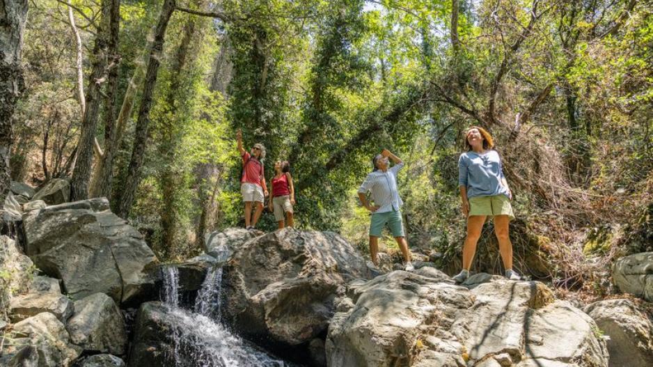
Length: 1.2 km | Altitude: approx. 870 m
-
Highlight: The highest waterfall in Cyprus, hidden deep in the mountains, with water from the Kryos River cascading 15 meters down a lush, damp gorge.
-
Historical Interest: The name “Millomeris” may derive from the Cypriot dialect word “millos” (meaning damp) and “meros” (place), describing the moist, cool surroundings.
-
Extra Tip: Millomeris was once little-known due to difficult access. With the opening of a dirt road and new works, it has become more popular and is now a well-established attraction in Platres.
-
Difficulty Level: 3
-
Length: 3 km | Altitude: approx. 1,700 m
-
Highlight: Dense vegetation, with the first 2 km passing through a rich forest of black pine, ending with stunning views at the Makria Kontarka location.
-
Extra Tip: As a linear trail, hikers must either arrange pickup from the point where it meets a forest road, or return via the same path, or by connecting with the Psilo Dentro–Pouziaris trail.
-
Difficulty Level: 1