120 km² Burned in Limassol Wildfire: Satellite Data Reveals Devastating Preliminary Impact
Nearly 9% of the Limassol district’s total area.
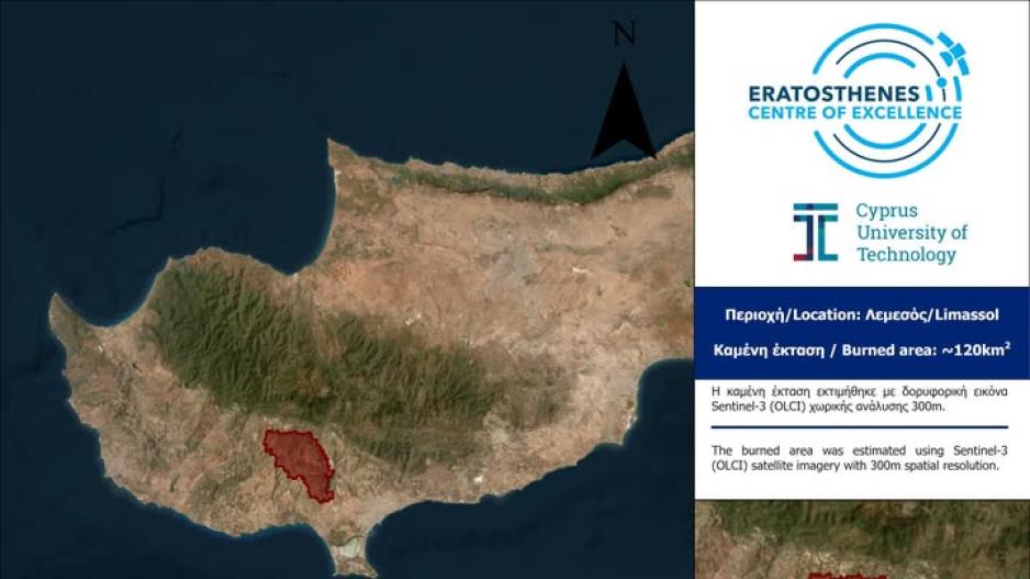
An estimated 120 square kilometers of land have been scorched in the devastating wildfire that swept through the Limassol district in Cyprus, according to an initial rapid assessment conducted by the ERATOSTHENES Centre of Excellence of the Cyprus University of Technology.
In its official announcement, ERATOSTHENES stated that the preliminary estimate was derived from a low-resolution satellite image captured by the Sentinel-3 satellite on July 24, 2025, at 07:30 UTC.
The satellite image used has a spatial resolution of 300 meters, and based on the analysis, the estimated burned area amounts to approximately 120 km².
To put this into perspective, this preliminary burned area represents:
-
8.9% of the total area of the Limassol district, which spans 1,393.314 km².
-
2.24% of the total area of the free territories of Cyprus, which covers 5,531.15 km².
Authorities emphasize that this is a provisional estimate, and a more accurate analysis will follow in the coming days, using higher-resolution satellite data.